Wall Chart Then and Now: Holy Land Relief Map (Laminated)
Rose PublishingChart 2015-02-18
Publisher Description
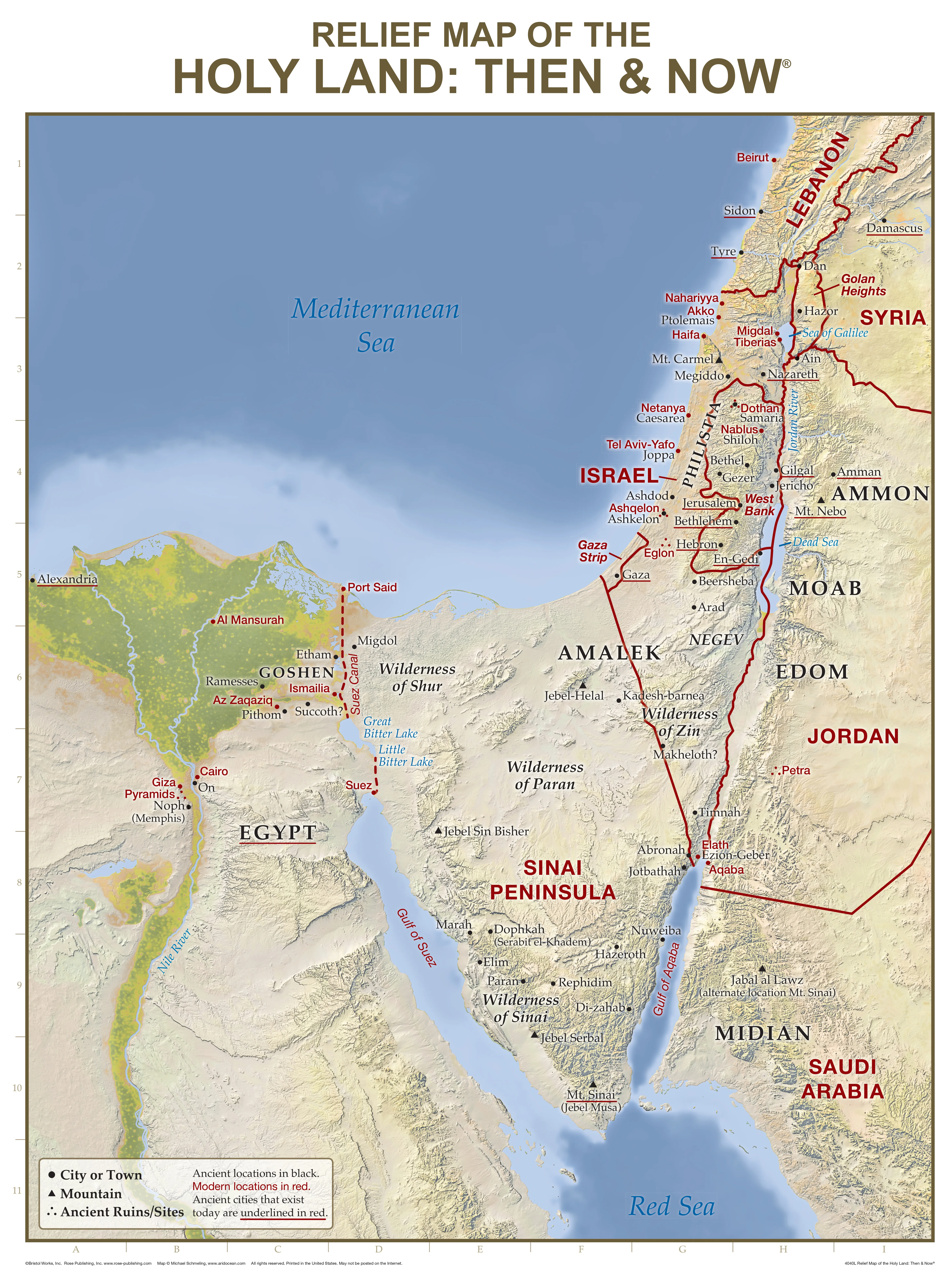
:Made available by popular demand!
"Then and Now" Bible Maps include detailed relief maps including mountains, valleys, rivers, and deserts. See where Bible places are today: red print lines show the major cities and boundaries of modern countries. Printed on heavy chart paper and laminated for durability, you can use water soluble markers to write-on and wipe-off with ease. Size: 19.5" x 26" Rose Publishing Product Code: 4040L
$25.99
$25.99
Click & collect: Select your store
Get information on product availability in store.

.png&w=64&q=75)
.png&w=64&q=75)

.png&w=48&q=75)
Publisher Description
:Made available by popular demand!
"Then and Now" Bible Maps include detailed relief maps including mountains, valleys, rivers, and deserts. See where Bible places are today: red print lines show the major cities and boundaries of modern countries. Printed on heavy chart paper and laminated for durability, you can use water soluble markers to write-on and wipe-off with ease. Size: 19.5" x 26" Rose Publishing Product Code: 4040L